http://www.weathernationtv.com/news/finished-goes-s-satellite-slated-launch-2018/
![]()
GOES 16 (the first one) is generating some nice images ![]()
Hi, does 16 only produce US maps?
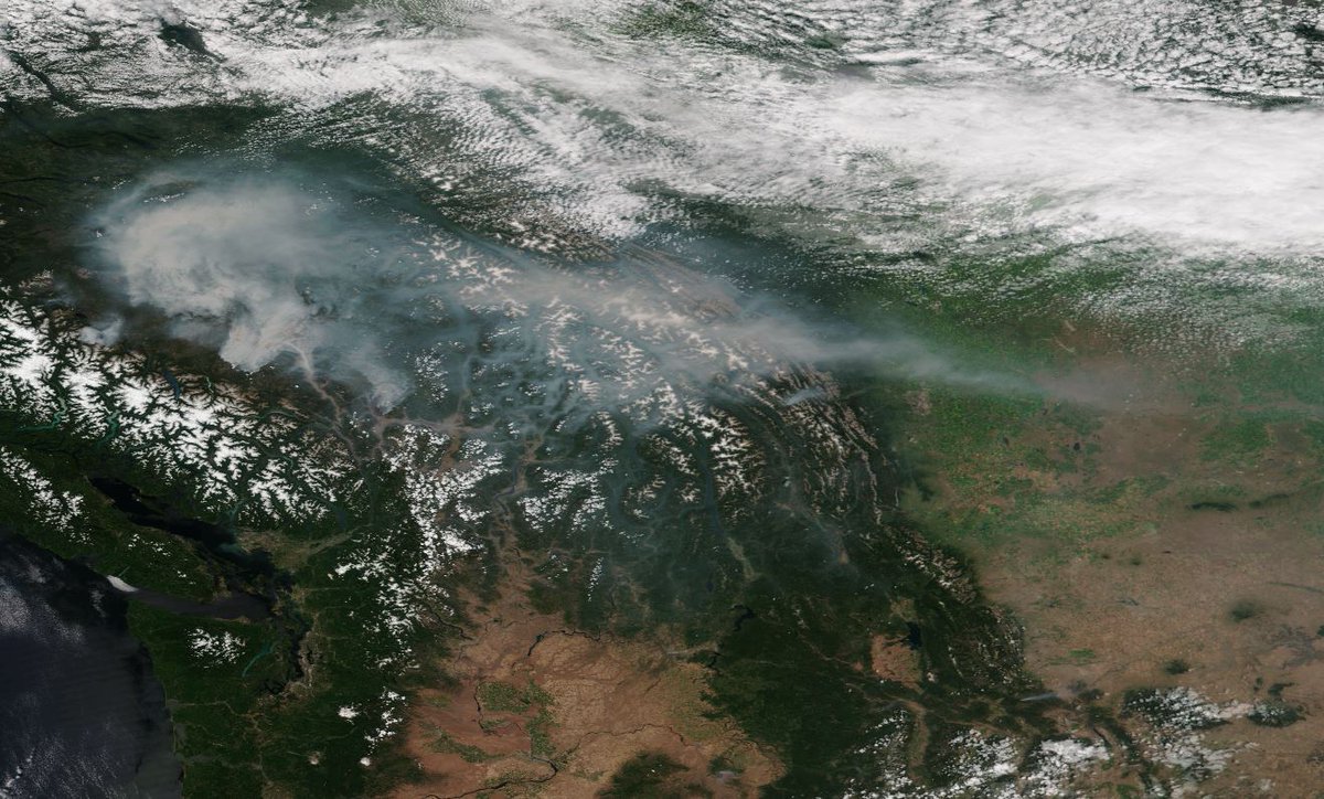
No, here’s British Columbia https://pbs.twimg.com/media/DFGc0JDWAAAeZ1S.jpg
Remember though that it is geostationary, i.e. parked at the equator, so it’s view towards the poles isn’t great.
Should be good for us on the left coast ![]()
Yep - looking forward to it.
The data from GEOS16 is fantastic! Huge improvement. They still have a few bugs in getting the data out occasionally, but all in all great pictures. The storm in the Northeast today is really impressive from GEOS16: http://mikeymsweather.com/wxGOES16-HAniSLoops.php Thanks to Jerry for the script.
Cheers
![]()
MikeyM
That’s terrible news! Hopefully they can come with some kind of a fix or workaround, but it sure doesn’t sound promising right now.
![]()
MikeyM
WooHoo! Now it has and we are getting GOES-17 (West) imagery ![]() It’s not fully good yet but the local TV guys are using it. Time lapse here
It’s not fully good yet but the local TV guys are using it. Time lapse here
That is nice!
Thanks Niko
Awesome!!! Thanks for sharing.