Hi Everyone,
I have noticed something interesting over the last several months. I run four forecasts per day. The first two at 0455 and 1055 are extremely accurate the second two at 1755 and 2055 are not very accurate at all. The two early forecasts are at about 70% accurate and the later ones are about 35% accurate.
Any suggestions on what setting might need to be adjusted.
Thanks for your help.
John
Thanks Tony,
I’ll check out the links.
John
Hi John,
On another topic (slightly related) I noticed your run times for WxSim are not evenly spaced (.ie 6 hourly).
Have not looked at your time difference to the GFS/Zulu run times, though wonder if you are as a result of the times your using, running the same GFS data for at least 2 of your runs.
I try and make sure I stay as close to the available GFS Data times for my runs and adjust them here in Southern Hemisphere due to Day Light Saving, see attached:
Update: I should add: by
as close to the available GFS Data times
I mean allowing time for the GFS run to complete and also for Tom’s/Sam’s Bohler process to complete and make WxSim-Lite data available for download, hence the reason I add “6hrs” to the say “00Z” time.
kind regards,
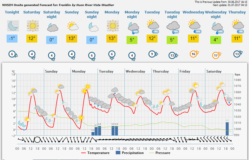
Hi John,
Sorry could not help myself when it comes to this subject, attached 2 images:
1: 06z run, current
2: 00z run, Previous
Note the difference in Temp(C)/Pressure(HPA) and then also the Precipitation(mm) which as Tom says is always going to be a 'crap shoot" :lol: between the two.
They will always differ, as (all 4 runs) use different modelling data and the environment changes for many reasons over time.
regards,
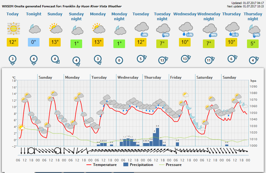
And here is the 12Z run.
Update
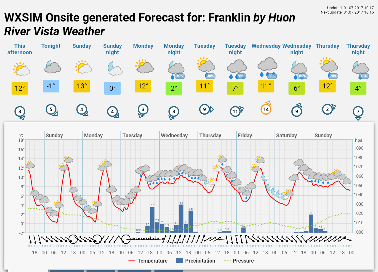
And the 18Z run.
regards,
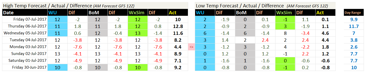
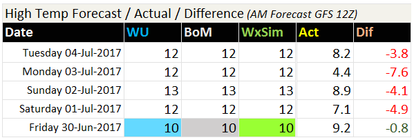
In comparison to the earlier post’s (same) forecasts, this would have to be the worst HIGH Temp Forecast I have seen in eons.
Even (WU/BoM and WxSim) failed big time, none handled the big Low Pressure event at all. Image below showing F/Cast Actual Dif in (C) Celsius.
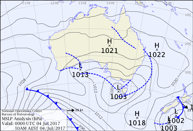
Quote from BoM Synop:
South East Tasmania Forecast - Weather (Synoptic) Situation:
A complex area of low pressure currently lies over Tasmania, with two low centres near the west coast and another just east of the state, each connected by troughs. The low complex is expected to move south of Tasmania tonight then move slowly eastwards tomorrow and Thursday, extending another trough over the state later on Wednesday. A ridge will then move over the state Thursday night ahead of a cold front later on Friday, followed by a more significant front Saturday afternoon and evening.
We also had a Record yesterday as a result, Lowest High Temp of 4.4c since onsite records began in 2010.
Chewing through the Firewood,
regards,
Ouch! Those are pretty far off the mark (though at least WXSIM had “good” company). Interesting to see your cold max temps. What were the mins? What’s the coldest min you’ve seen there? Was there any snow down to sea level?
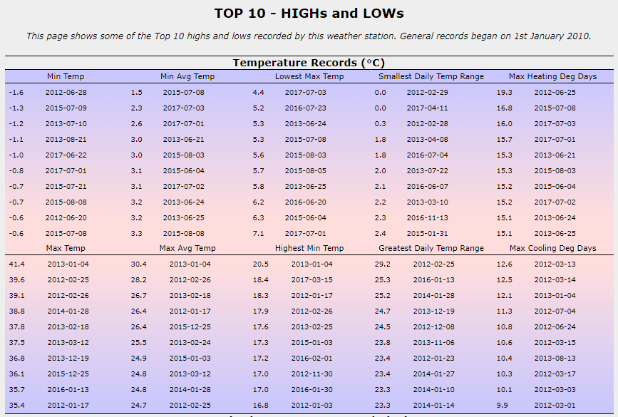
Hi Tom,
Images below to answer your questions, although the overall min max’s are missing my 2011/2010 data as it was too corrupt. (but actually Low was: -1.8